<< Previous | Motivation | Florida | Georgia | North Carolina | Georgia Home | Florida Home | Next >>
The Heritage 441 Run to the Great Smoky Mountains
The (Best Laid Plans) Georgia route...
Crossing into Georgia we head into Fargo, nearly 40 miles north of Lake City, on HERITAGE 441. At Fargo we may find our way to Stephen Foster Memorial Park. However, it takes us 17 miles away from US441, down a dead end road, to enter the park which is in the Okefenokee Swamp. The famous Suwannee River starts in this swamp, and we will cross it on Heritage 441, just south of Fargo. Then it's on through Homerville, Pearson, and into Douglas. Note that heading east from either of Homerville or Pearson puts us in Waycross.
Douglas is another 100 miles from Lake City, Florida, and a little more than 250 miles or about 6 hours from our starting point if we average 40MPH. Obviously this will depend a great deal on the weather, how many stops we make, etc. So we look at calling it a day and check in to General Coffee State Park and stay in the Burnham House, a 19th Century cabin. Still 75 more miles to the midpoint in Dublin... While it is tempting to make it to the halfway point the first day, getting there is not the point! Besides, the cabins at the state park have a minimum two night stay.
The Revised Georgia route...
Planning around the two night minimum stay worked out well for us. Originally we thought after the first day of riding we may not feel like riding another solid day. Since we would be close to Waycross, just north of the Okefenokee Swamp, where some friends have land out in the middle of nowhere, we figured we could explore the area with the extra day. After my head gasket blew in Ocala and set us back a day, we decided to just stay on I-75 out of Florida into Georgia to Valdosta and then cut across GA84 straight into Douglas.
We made record time and arrived and checked in before 3:00 PM! We went back into town to find a grocery store, only to discover, in Georgia, you can't buy alcohol on Sunday! It wouldn't have been a problem had we made it there Saturday, but it really wasn't a problem to go a day without beer... I may have complained a bit, but as an afterthought we figured we'd just get some tea bags and ice and use the coffee maker to brew some 'iced' tea. Not quite the Mr. Coffee Ice Tea Maker at home, but then again, it works and we're supposed to be 'roughing it', right?. We finally used up the rest of those tea bags yesterday (9 September 2008).
We settled in after returning from the grocery store and Ann kept hearing roosters crow. She wanted to go find them. So as we waited for dinner to bake in the oven, we took a walk around the historic farm. We walked around the small lake and up to the playground. We noticed there was a nature trail below the pavillion that followed the 17 mile river, so we decided to take it and see what the 17 mile river looked like. Turns out to be a very slow moving river, more like a swamp, full of big @$$ cypress trees and such.
We returned to the cabin to enjoy dinner then it was on down the road to the pool to walk it off. The pool was a bit closer than we thought so we walked nearly to the end of the road before turning around. As we passed the pool we decided to come back via the nature trail and ended up on the other side of that same pavillion that started the 17 mile river tour. By the time we got back to the cabin I was really feeling it. That's all the walking I'm doin', we're in for the night! We watched some TV as we kept an eye on Tropical Storm Fay and called it a night.
As it turned out, we ended up being the only ones to spend the night in the park, at least as far as we could tell. As we took our walk early the next morning we realized there wasn't anyone else there. Not a single person or vehicle at any of the other cabins. Our walk turned into a bit of a hike when we decided to take one of the nature trails through the thick, old growth canopy. We emerged back onto what we thought was the road back to the cabin and started in that direction, our so we thought...
We walked to one end of the road until it ended in a cul-de-sac, turned around and walked all the way to the other end, guarded by another gate (locked) which we weren't familiar with. So now we had to go back and find the nature trail, the correct one, the one we were on and not the other ones, and go back the way we came. Guess we should have brought the map! It was all good though. The more we walked the more and more around us we began to see: a deer so close we could almost touch it before it started away; a really neat and nasty looking spider; big, fat ol' bushy tailed squirrels everywhere, not those scrawny looking ones like we have back in Florida.
Eventually we make it back to familiar territory and, finally, the cabin. Turns out, after looking at the map, there are actually two roads into the park and they aren't connected, at least not internally. We had walked nearly four miles! Good thing we weren't in a hurry to get on the road. We made another pot of coffee and enjoyed it with some of the cheese danish we bought the day before as we wound down and cooled off from our hike. We took our time, got cleaned up, packed up, loaded the car and checked out. That was fun! Next adventure...
The Georgia route, day two...
Back on the road from Douglas we head toward Broxton, Jacksonville, McRae, Irwinton, and Dublin. This is the midpoint, about 75 miles from the cabin... There are a couple of bed and breakfast inns around Dublin, the Country Bed & Breakfast& Vacation Farm and the Page House Bed and Breakfast. Many fine restaurants as well. Google maps says it would have been 8 hours to here from Apopka, so we definitely wanted to be staying in Douglas. Too bad since El Amigo Mexican Restaurant is just down the road from the Page House. Great for dinner, but not so good for breakfast?
North of Dublin, two lanes becomes four most of the rest of the way to the Smoky Mountains through Milledgeville and Eatonton, home of Brer Rabbit and Uncle Remus. Most of these smaller towns have a bypass route around the town, either in the planning stages or already completed. As you can imagine, it has generated a great debate between downtown merchants and greedy politicians, the most likely owners of the very soon to be very valuable land on the bypass route.
Then comes one of the prettiest towns on the trip... Madison. But we must leave the bypass and take the historic business 441 route to see it. It is known regionally as "The Town Sherman Refused to Burn," on what is known as the Antebellum Trail, a 100 mile stretch untouched by General Sherman and his burning "March to the Sea" during the Civil War. Most of its nearly 100 Antebellum homes have been carefully restored, which led to Holiday Travel magazine's naming Madison "The Prettiest Small Town in America."
Whether it is a pre-dawn beginning, or an overnight stop, it is usually lunch time in Madison, along with a little antique shopping, maybe even a visit to the Microcar Museum. We must have passed right by it but we didn't see it. Madison is indeed beautiful and with the fall semester starting soon we were seeing quite a few college students around town.
We had taken the downtown route through Milledgeville looking for a place to eat lunch but were through it and on to Eatonton before we knew it. I don't recall if the Mickey D's we stopped at for lunch was in Eatonton or Madison. It seemed to fly in the face of the very idea at the heart of our adventure but Ann was hungry and she gets grumpy if she doesn't eat so I didn't mind (much). In any case, it was nice to get out of the car for a bit and stretch. Ann's Miata definitely was NOT designed for someone with a 6'2" frame like mine.
With our tummies full, up the road we go through Bishop and Watkinsville to get to Athens. I'm still looking for other 'attractions' in the Athens area and originally I figured we'd probably just stop for a 'bite' to eat there. Forgive the pun, I just couldn't resist - Georgia Bulldogs, 'bite', get it? Anyway, by the time we got there we weren't that hungry and as it turned out, there was more to navigating around Athens than I originally thought...
We missed the first chance to get on the Athens bypass but thankfully US441 continued on and eventually ended at the bypass farther down the road. That wasn't the end of the surprises though. Even though it's called a 'bypass', we still had to take exits and merge onto the next highway going in the proper direction. First east, then north, then west back to US441 north again. I tried to quickly decipher the maps I had printed out at home. Tempers began to flare. It was very confusing and we had to double back in a few places. We eventually calmed down, but looking back, had we been on the bikes we could have easily been separated and found ourselves in a very scary situation.
The Smoky Mountains are still our destination, so it is off the Athens bypass, back on to US441, through Commerce. Up the road a piece, we go through Cornelia, Demorest, and Clarksville - all within a few miles of one another. Too bad we're not coming through in October for the Big Red Apple Festival in Cornelia, looks to be a lot of fun. Cornelia is about 80 miles NE of Atlanta (google maps says 1 hour and 24 minutes away). In any case, we have more choices again.
As mentioned earlier, the four lane bypass will neatly skirt these small towns,
or
we can take the 2 lane business route through the towns,
or
there are even routes marked Historic 441 and Old GA 441 out of Clarkesville to further confuse matters.
I didn't think we'd be able to make it all the way to Clayton the third day (second travel day), maybe Cornelia or Clarkesville though. There seems to be plenty to explore in this neck of the woods. Nearby Toccoa Falls, nearly due east of Clarkesville, was the scene of a massive flood when the Kelly Barnes Dam broke in 1977, killing 39 people. The dam was originally built in 1899 as a rock crib (boulder) dam to feed headwater into a hydroelectric power plant, then modified numerous times to its earthen dam status before the power plant was shut down in 1957.
We thought we'd take the Historic 441 route so we can do the walking tour of Clarkesville, maybe have some dinner first, and put in for the night there. There's a wonderful Bed and Breakfast I found in Clarkesville, well... it said in Clarkesville, but it's way the Hell out in the middle of East Bum you-know-where, almost to Tallulah Falls, another 15 miles down the road! And back roads at that. When we came to the "PAVEMENT ENDS" sign, we knew for sure why the head gasket blew, the last mile or so being a narrow dirt road. Actually it was more like large, crushed granite gravel and would have toppled us off our top heavy motorcycles.
Even before we arrive at the Glen-Ella Inn, we know this will be the highlight of our trip - as we draw near to the Inn we see deer grazing in the rolling field between the inn and the springs - then the majestic inn itself appears through the trees. We pull into the small parking area and head for the office, noting the peculiar and comical 'faces' on the trees that line the walk there.
We need to look for other lodging if we ride the bikes next time though. Earlier I was thinking the Burns-Sutton Inn would have been a good place, right in downtown at the far end of the walking tour, but it's been closed for quite a few years and is now a real estate office. May not be much else there, don't know since we didn't end up taking the walking tour. Once we got to Glen-Ella, we didn't want to leave.
I was pretty sure after the second 6 hour day of riding all we'd want to do is eat and sleep, maybe soaking in a hot tub (some rooms have one) first. Instead we decide to partake of the local Habersham County Chardonnay rather than travel all the way back into town for beer. As we sat there taking everything in, we noticed more than a dozen hummingbirds sharing, visiting and fighting over the feeders. We order another bottle of the Chardonnay and decide to just have our dinner there on the patio too.
Dinner did not disappoint. We set out to walk it off around the garden, across the rolling fields and then down to the springs. We watched three deer almost as intently as they watched us approach the wooded entrance to the springs. At least that's where we guessed it was as a fourth popped its head out as if to say, "They're not coming here now are they?"
We walked back the deer trail as far as we could go in our sandles before turning back. We watch the spectacular sunset as we head for the room to grab the laptop to check on Tropical Storm Fay at the club house. Well, someone else beat us to the TV and they were already watching the Olympics, so I jokingly asked, "Who's winning?" and got a short, "It's still the qualifying." as if I should know that and care. Before I could say, "Well excuse the F... out of me @$$hole!" I whipped out the laptop and turned it on. As it booted we had the pleasure of meeting Ed, the caretaker. I think he liked my version of the Imac girl as my wallpaper, he couldn't take his eyes off it! But better than that, we talked and talked and annoyed the old farts watching the Olympics... Nothing like spending your vacation at an expensive bed & breakfast just to watch TV!
Fay is still trying to decide whether to come up the middle of Florida, so I check my email and we head back to our room. We discuss heading back into town in the morning to take the walking tour but decide better of it. We read a bit until turning out the lights. There is plenty to explore in the morning going the other way too. Since we're only a couple hours from the mountains now, we can take our time getting back on the road... It's only about 40 miles (an hour) from the Georgia - North Carolina border, 55 miles (1:30) to Franklin and 90 miles (2:20) to Cherokee or Bryson City.
The Georgia route, day three...
Back on the road, soon enough we come to Tallulah Falls and the Tallulah Gorge. Tallulah Falls was the filming location for the movie Deliverance. On July 18, 1970, Karl Wallenda became the second man to walk across the gorge on a tightrope. We ride right past the dam and over the gorge, or would have, had we not detoured onto bypass 15 to the Tallulah Point Overlook.
We looked over the souvenirs, picked up some new refridgerator magnets, a book on the history Tallulah Falls Railroad, and finally made it onto the overlook. I didn't realize how far down into the gorge the falls were - there are more than one - five in all, in staircase fashion. I don't know why I expected to see them all from one point, especially when the waitress told us the night before it would be some hiking to get there... Now I knew what she meant. Ann wouldn't go anywhere near the railing so I jokingly called her a sissy and got a few laughs from the siteseers there. She gave me the pouty lip the rest of the way to Dillard House.
Just past the Tallulah River bridge, there is a turn off to the left, then a quick right. This is truly historic, Old GA-441. This will take us to Clayton, the next town, only about 15 minutes longer than taking the bypass. The bypass skirts the gorge while Old GA-441 follows the along east edge of the gorge and the man made Lake Tallulah. We originally thought about parking along the falls and walking (hiking) down to see them, all five... right. Once we leave Tallulah Falls Overlook, we begin to see the mountains on the horizon, and are officially in North Georgia.
All these towns north of Dublin, have a historic 441 business route, through the town, including Clayton. Just north of Clayton is where the bypass is not completed yet, and our trip takes us on through Mountain City, and Dillard. Lunch awaits us at the Dillard House, a must! We read they have the best fried chicken and had to stop and try it. It wasn't quite what we expected... You don't order what you want from a menu, they bring you EVERYTHING on the menu! We sample a little of everything, fried chicken, smoked chicken, pork chops, mashed potatoes, gravy, cabbage casserole, squash casserole, corn on the cob, beans, etc. The rolls and cole slaw are already on the table when they seat you.
It's what they call family style. Can you say STUFFED? We rolled out of there and headed back to US441. Orlando and Otto await us... just across the North Carolina border that is...
<< Previous | Motivation | Florida | Georgia | North Carolina | Georgia Home | Florida Home | Next >>
Trip Pics and Things Remembered


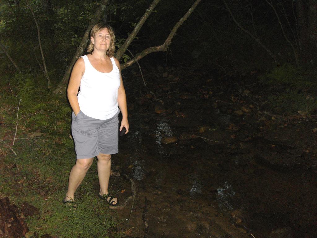
Our arrival at General Coffee State Park, Douglas GA. You'll notice we're in Ann's Miata, not on our motorcycles. My head gasket blew as we were leaving Ocala, about two hours into our trip. We got settled in, put supper in the oven and took a look around the park. Ann wanted to find the roosters, and we did, at the historic Georgia farm portion of the park.
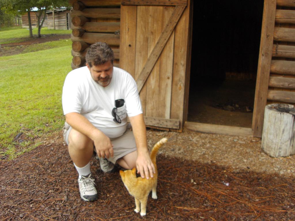

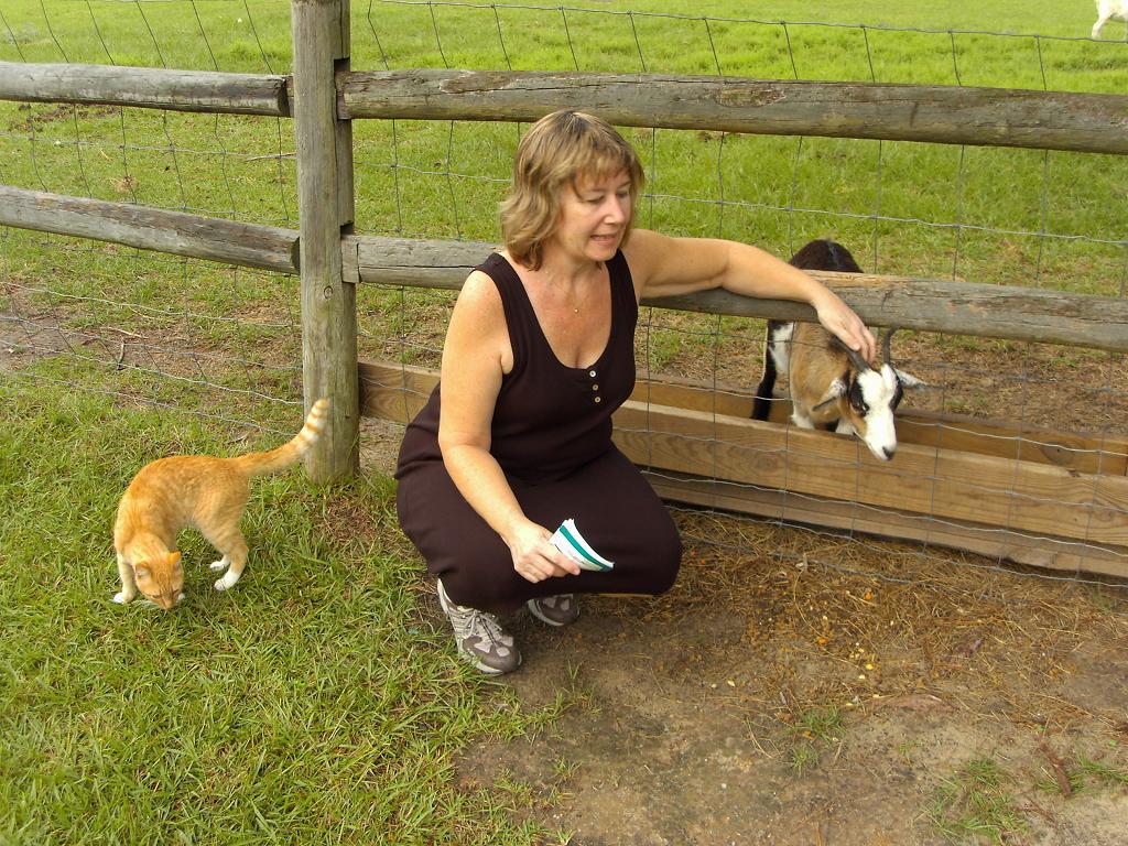
I thought we left the animals at home but we just can't seem to get away from them! This stray followed us for a bit then disappeared. Ann wants to bring home a little goat buddy for our dog Wren.


Ann's ready to go, and yes, she meant to wear those sneakers with that dress AND wanted me to take the picture. Mules and goats shared the pasture. Everywhere you look there are trees. There's even one growing out of my head! We eventually made it to the nature trails, one of which follows the 17 mile river (more like swamp), full of cypress trees like this huge specimen.


Ann just loves the goats but we kept hearing something else, sounded like kids playing a trick or a very sick goat. Turns out to be the bleat of this sheep. Not sure why, but these two were sequestered with some other animals in this building. The sheep was chewin at the branch just to the left.


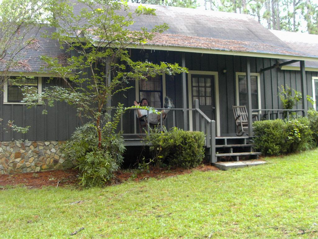
As we returned to the cabin, I decided to snap some pictures to show the size of our cabin and the Burnham Cottage, which sleeps 8 - 10. We had the whole park to ourselves that night. The next morning we got a bit lost but (eventually) did manage to find our way back and get on the road to our next destination...

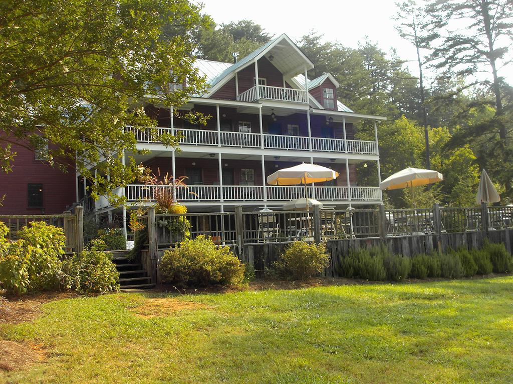
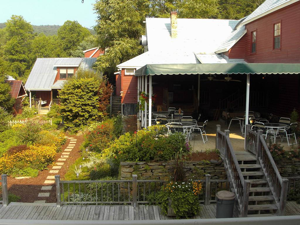
Our arrival at Glen-Ella Springs is simply enchanting. As we approach the inn, deer are grazing in the field between the inn and the springs. As we walk to the office, we notice faces on the trees lining the walk. Our room is on the lower porch at the very right.


Once we settle in, we decide to sit on the patio and take in the view of the garden. We didn't want to leave, so we ordered a bottle of the local Habersham County Chardonnay.


It didn't take long to notice more than a dozen hummingbirds sharing, visiting and fighting over the feeders. We ordered another bottle of the Chardonnay and decided to just have our dinner there too.


This is the view of the inn from the pasture looking through the gardens. We walked the grounds after dinner to get a feel for the layout. Ann is standing in the lower garden.


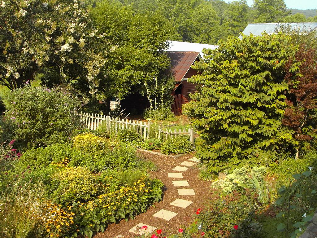
These pictures don't do the garden justice. It looks 'overgrown' but it's really just the angle of the shot. There are multiple paths through it. As we approach the 'clubhouse', the plants are brimming with flying insects like bees or hornets or something, but they were so busy harvesting the nectar from the flowers they didn't even notice us.
As we walk toward the springs, three deer grazing the field move closer to the forest concealing the springs. A fourth pops out from the 'entrance' as if to say, "They're not coming here now, are they?" Our last glimpse of the inn in the distance before entering the forest shows how far away it is.


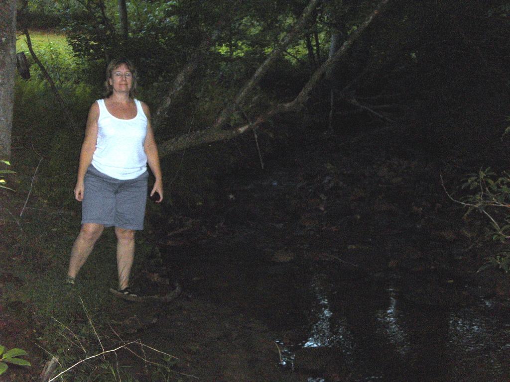
We walked the deer trails as best we could in our sandals, not the best shoes for hiking through the woods, but we did manage to travel upstream until we couldn't go any farther and had to turn around.


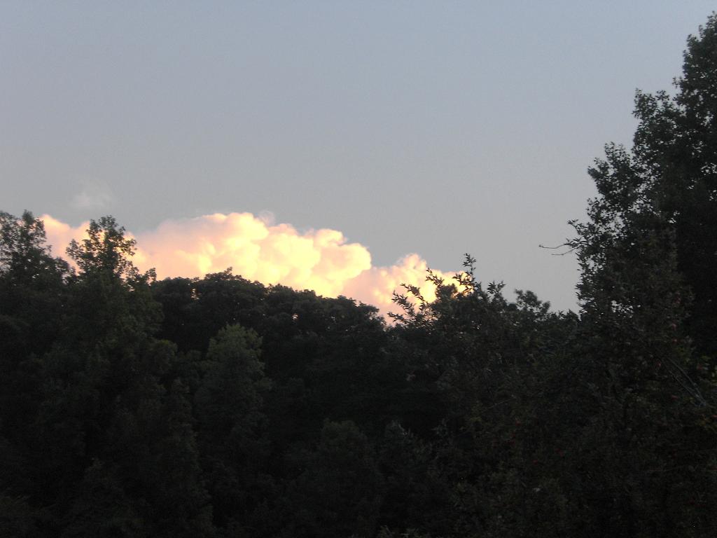
We are definitely in north Georgia, surrounded by mountains and enjoying the sunset. The views to the left and right are closeups of the center view.


This mill is the last of many fond memories of Glen-Ella as we move on to Tallulah Falls. I wanted to get a shot of the "Pavement Ends" sign, but the shot I want isn't possible. You can see a glimpse of the dirt road on the right in the last picture though.


Though we are sad we have to leave Glen-Ella, we decide to take the 15 bypass to the Tallulah Point Overlook. While I enjoy it thoroughly, because of Ann's fear of heights, she doesn't. She wouldn't even get close to the edge. There are actually five falls, one after another, in stair case fashion.


To get these telephoto shots I had to rest the camera on the porch railing overlooking the drop into the gorge. Ann was beside herself now, yelling at me to be careful. I jokingly called her a sissy and got a few laughs from the siteseers there. She gave me the pouty lip the rest of the way to Dillard House.